


BUFFALO, N.Y. (WKBW) — A strong system will cross WNY on Saturday with heavy rain, strong winds, hail and even a low risk of an isolated tornado possible.

WATCH: Autumn Lewandowski explains how to identify different risk categories when tracking severe weather.
There will be a one, two punch with this system as first a warm front crosses the area and then a cold front later in the day. With the warm front expect heavy rain and some embedded thunderstorms, some of which may have torrential rain, and may turn severe with an isolated brief tornado threat.
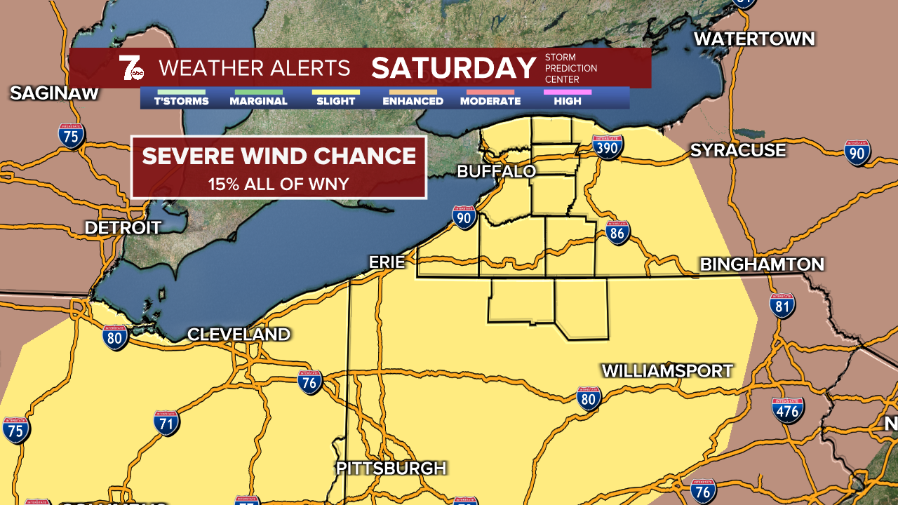
As the day progresses a front cold front will move into the region giving the atmosphere the added lift to help strong storms become severe. All of WNY is under a slight risk for severe weather with a 15% chance of 60mph wind gusts as you can see in the image above from the Storm Prediction Center.

There is also a 5% chance of hail, typically penny to quarter sized in severe storms across our area but ping pong ball sized hail has been forecasted and could be larger in some cases.

There is also a risk of tornadic activity across all of WNY which we typically don't see, or at the very least not often. Usually worded as a non-zero chance Saturday afternoon for all of WNY and a 5% chance for the S.Tier and into northern Pennsylvania.
The cold front offers the lift for storms to grown and become severe but it also offers "turning" in the atmosphere, called wind sheer and that's why there is a chance, albeit low but a chance for tornadic activity into the afternoon/evening. The question mark will be how much warming can take place between the morning rain and the afternoon front. If the morning rain stays longer and cools down the atmosphere that will limit the severe potential in the afternoon. If it dries out a bit, some sun can warm things up again, the afternoon storms have a better chance at growing and turning severe. Flooding will also be a concern with amounts ranging from about an 1" to localized amounts near 2" within thunderstorms.
Stay with WKBW and the weather team through the weekend and get the most up to date forecast by clicking here.
